Passage Planners
Helping sailors to plan sea voyages
Waterproof & Reusable Passage Planning Forms
Made in Exeter - Devon - United Kingdom
CLICK HERE TO VISIT OUR MAIN SITE (https://passageplanning-sales.com)
An Introduction to Passage Planners and how our forms can help with your sailing planning.
We are a UK website based in the South West of England and welcome you to our site dedicated to Passage Planning forms. Our forms are designed to help and guide on how to prepare a passage plan for marine navigation for use en-route, and they can be used in the cockpit of your sailing yacht, motor yacht or any other marine transport. All our passage,
pilotage and port of refuge planning forms are encapsulated in high quality A4 size matt plastic pouches. These provide waterproof surfaces for writing on with 2HB pencil, and can be edited
as required during the passage. Our ready to use forms are designed for multiple use and can be erased at the voyage completion, for reuse on your next passage.
Our www.passageplanning-sales.com site uses a SSL Certificate, so any data sent
between us will be securely encrypted.
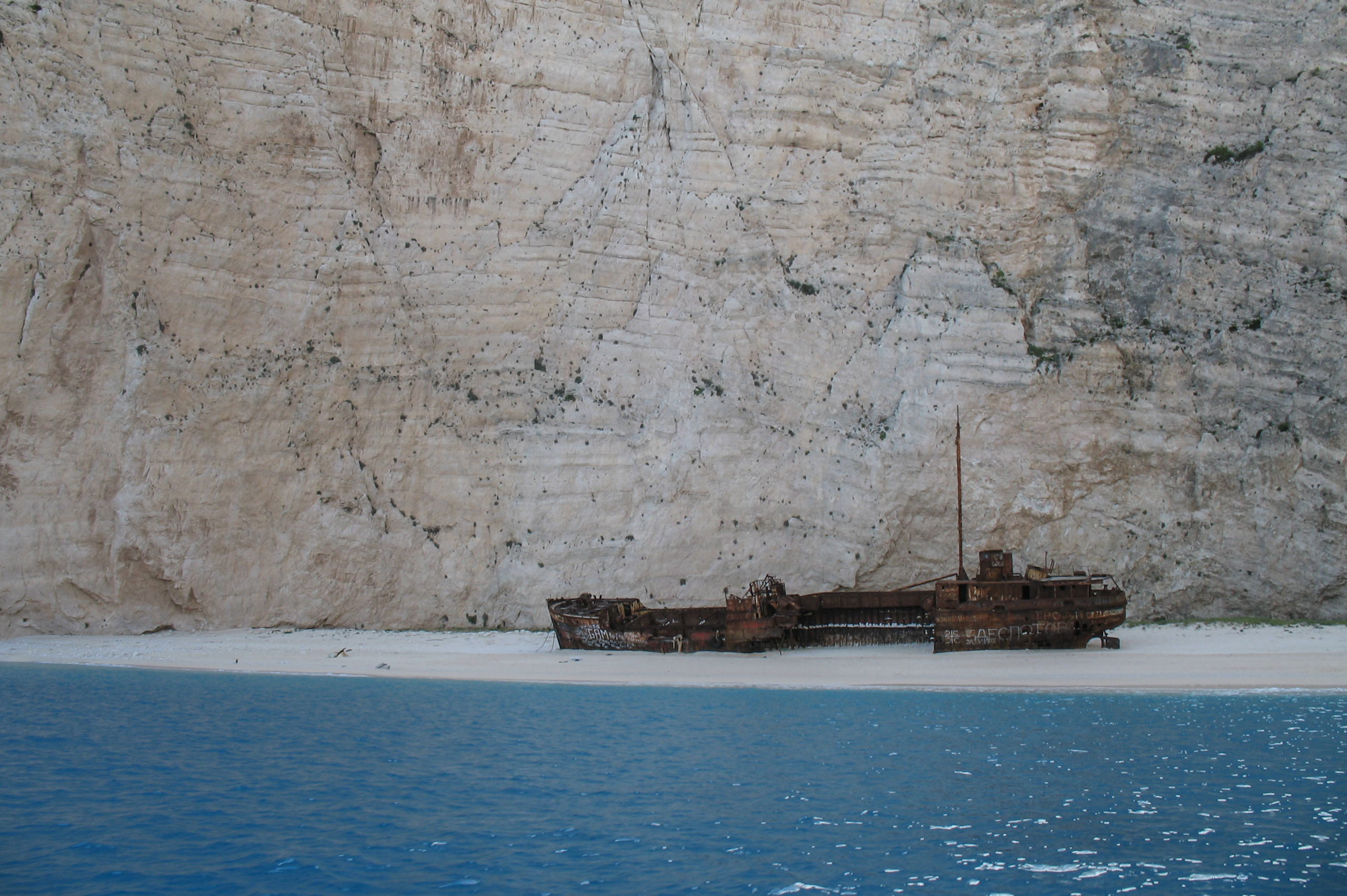
Why and who should write a passage plan? (other than, perhaps, the skipper of this freighter on the right!)
Most sailors learn how to develop a passage plan during their training for their International Certificate of Competence (ICC), RYA Day Skipper, Coastal Skipper or Yacht Master qualifications. However not every sailor studies for a formal sailing qualification and may rely upon the many excellent publications
dedicated to teaching such skills. We are presenting our forms to you to help you put your ideas down on paper as a means to assist and speed your planning.We have also demonstrated how to write a passage and pilotage plan and explain how our passage planning forms can assist you to in preparing the plan in our "Passage Planning Examples" page (opens in new tab). The following notes are intended to outline the fundamentals of passage and pilotage planning and to to encourage your interest in the passage planning process. Another part of our website offers help and advice in a basic passage plan guide to writing techniques which we hope will be of particular use to existing sailors and those taking RYA sailing and navigation courses.
UK law requires every skipper/navigator to prepare a suitable passage plan prior to putting to sea. From start to completion (dock to dock), the voyage of each vessel must be described. This must include leaving the mooring and harbour area (pilotage), the main part of the journey (passage plan) and the approach and entrance/docking at the destination port (pilotage). These events are required to be documented for all vessels whether a small cruising yacht sailed by a leisure sailor, or a massive commercial freight carrier. SOLAS (International Convention for the safety of life at sea) requires a passage plan to be made even if it is only for a short leisure sail. And it needs to be written down. Failure to comply can lead to errors and navigational accidents. Even the use of passage planning software requires the plan to be written down prior to the proposed sea passage.
The passage plan is required to be monitored throughout its execution, and this is the responsibility of the skipper, as is everything else on the voyage. The passage plan needs to adequately describe the voyage with particular regard to navigation, tidal height planning and the effects of tidal streams and currents, hazards en route, sea conditions and the anticipated passage weather and wind anticipated during the passage. Other considerations of note are the safety aspects of the vessel and crew including the capacity and experience of the crew to cope with the voyage, and the stores required on board to feed the crew.
Generally each passage plan will start with the navigator drawing the proposed route on a suitable nautical chart(s) covering the area of the passage in question. The initial track may be redrawn to be efficient, safe and with particular reference to adequate under keel clearances, TSS (Traffic Separation) systems, time/speed restrictions, height clearance, military ranges, tidal gates on passage, hazards en route, contingencies in the event of emergencies and/or bad weather and, indeed, any other laws or regulations applicable to those who go to sea.
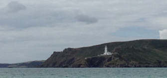
Start Point, Devon, UK - A notorious tidal race may be encountered at this formidable headland. The passage plan must take into account tidal gates such as this for a safe and enjoyable passage to be maintained.
Pilotage, generally undertaken at the start
and end of each voyage, needs every
attention as these are the times when
mistakes can be made, particularly at the
end of a long passage when skipper and crew may be tired. Although used in tandem with the passage plan, the pilotage may be planned separately using the same principles as the passage plan but referring to more detailed and large-scale charts of approaches to harbours and fairways
and with due concern to navigational buoys, lights and marks, navigational hazards, increased local traffic, tidal restraints and currents, speed limits and rules and regulations particular to the destination port and harbour authority. In particular, the use and rerence to a suitable pilot book/almanac (such as Reeds Nautical Almanac) is not only advisable, but essential in such matters of pilotage. There are many other pilot books written by authors with experience to specific areas of the coasts of Britain (e.g 'The Shell Channel Pilot', edited by Tom Cunliffe or 'Ionian' by Rod Heikell, covering Greek waters) and indeed every coast in the world. Although most local sailors complete voyages during the daylight, this is not always the case and
skippers need to be aware that they may neeed to prepare for leaving or arriving at a port in darkness. This puts an even greater pressure on crew and skipper alike, and requires skills not practiced on an everyday basis. In the event of night sailing/arrival in the dark, the passage and pilotage plan is required to take this into account. In the event of a delay during passage, requiring a change or adjustment of the plan and/or pilotage this needs to be written into the documents describing the plan.
All voyages of any length need, in particular, to take into account both tidal and weather considerations. Although tide times are predictable, the weather is less so and can change, as can wind conditions en route, from that predicted at the start of the voyage. Thus, conditions
can change and the combination of tide, sea condition and wind could mean that the passage plan is not practical or even possible to follow safely. Emergencies can happen which could
have the same effect on the plan and it is for the skipper to decide whether to deviate from the passage plan and to head for a "Port of Refuge". Such ports may be in short supply! For instance, a passage from Weymouth on the Dorset coast, to Brixham in Devon is a distance of about 45 to 50 miles depending on whether sailing is possible close to Portland Bill. The most direct route from Portland Bill is straight across Lyme Bay, a distance of approx. 42 miles. The coast to the north of the route (Lyme Regis, Bridport) is some 16 miles away and, in any event neither port could be really considered to be a suitable port of refuge. Thus, the nearest refuge port to Brixham is Dartmouth and unless you were blown well to the south west, it could not be
to any advantage, neither could the Exe river to the north east of Brixham.
However if you were cruising from Brixham to Falmouth, there would be several refuge ports available such as Salcombe, Plymouth, Fowey, even possibly Mevagissey (not a suitable foul weather refuge), should a change in plan be necessary.
As such, any passage plan is required to take Ports of Refuge into consideration and the pilotage into such chosen ports is a necessary part of passage planning writing. A separate pilotage plan, including berthing planning, should be prepared for such an eventuality, to include the details one would take into account as if it were an anticipated destination port and must be completed to the same detail as your chosen destination.
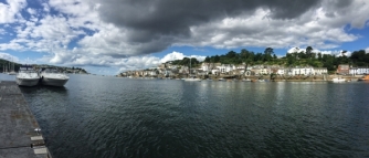
Fowey, Cornwall, UK - Easy pilotage into this harbour makes it a good Port of Refuge, if required between, say Brixham and Falmouth.
What next?
Following the completion of the passage plan, most navigator/skippers will put the details of the planned route into an electronic chart
plotter situated in the cockpit or above the
chart table (or both) of the vessel. Most
cruising vessels nowadays are fitted with a chart plotter, either as part of the original equipment or as an navigation extra.
Alternatively a GPS unit or even a iPad may be used to store the details. The inputted details should include both the pilotage and, possible suitable ports of refuge. GPS is great for most of the time. However it’s not a good idea to entirely rely on it. If you have made an error in entering data, like a car sat nav system you don't end up where you intended. It is the same at sea! The GPS signal and accuracy is not infallible and the signal can be vulnerable to outside influences. Like any other electrical equipment it can just stop working at an inconvenient time. Always
have a passage plan written down (and don’t let the wind blow it away! Take a snapshot of it
with your mobile phone, just in case).
Prior to the start of the passage the skipper will discuss the plan with the navigator and other crew members so that all are aware of the route and intentions of the skipper.
During the ongoing voyage the passage plan should be regarded as 'a living document' to be monitored and, if necessary safely adjusted to suit changes in conditions imposed on the
original plan by any special or even unplanned circumstances.
During the voyage the passage plan should at all times be available to the skipper/watch crew and must be monitored throughout with regard to the progress of the vessel. The track of a
yacht or motor vessel can be affected during the progress of the passage by, in particular wind and tidal streams, however there are other contributing factors which could affect the course which require to be constantly monitored. This generally is carried out by traditional means and requires the vessel's position to be determined in relation to the planned course by methods including dead reckoning, position fixing, pilotage and electronic positioning fixing and route monitoring. Such observed details are required to be entered in the boat's log as necessary. By so doing the plan as designed prior to leaving port will be closely monited throughout the passage.
Having a robust written Passage and Pilotage Plan is essential for a safe and enjoyable
voyage. Our forms for planning and making a passage, together with pilotage and port of refuge planning forms, and other helpful tidal stream and fuel planning forms are designed to help you with your navigation planning and are designed to be be easy to use to the extent that details
can be revised should you find that there are differences between the circumstances you assumed you may meet when you wrote your initial passage plan, and those you actually encounter on the voyage. Our planning forms are encapsulated, waterproof and, when used as templates for your passage planning, can be reused time and time again. The matt finish can
be written on using 2HB pencil which can be erased later, ready for your next plan.
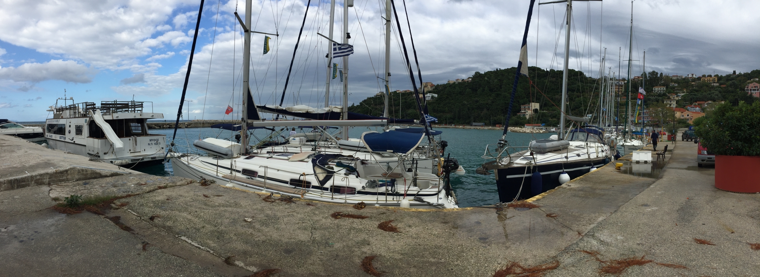
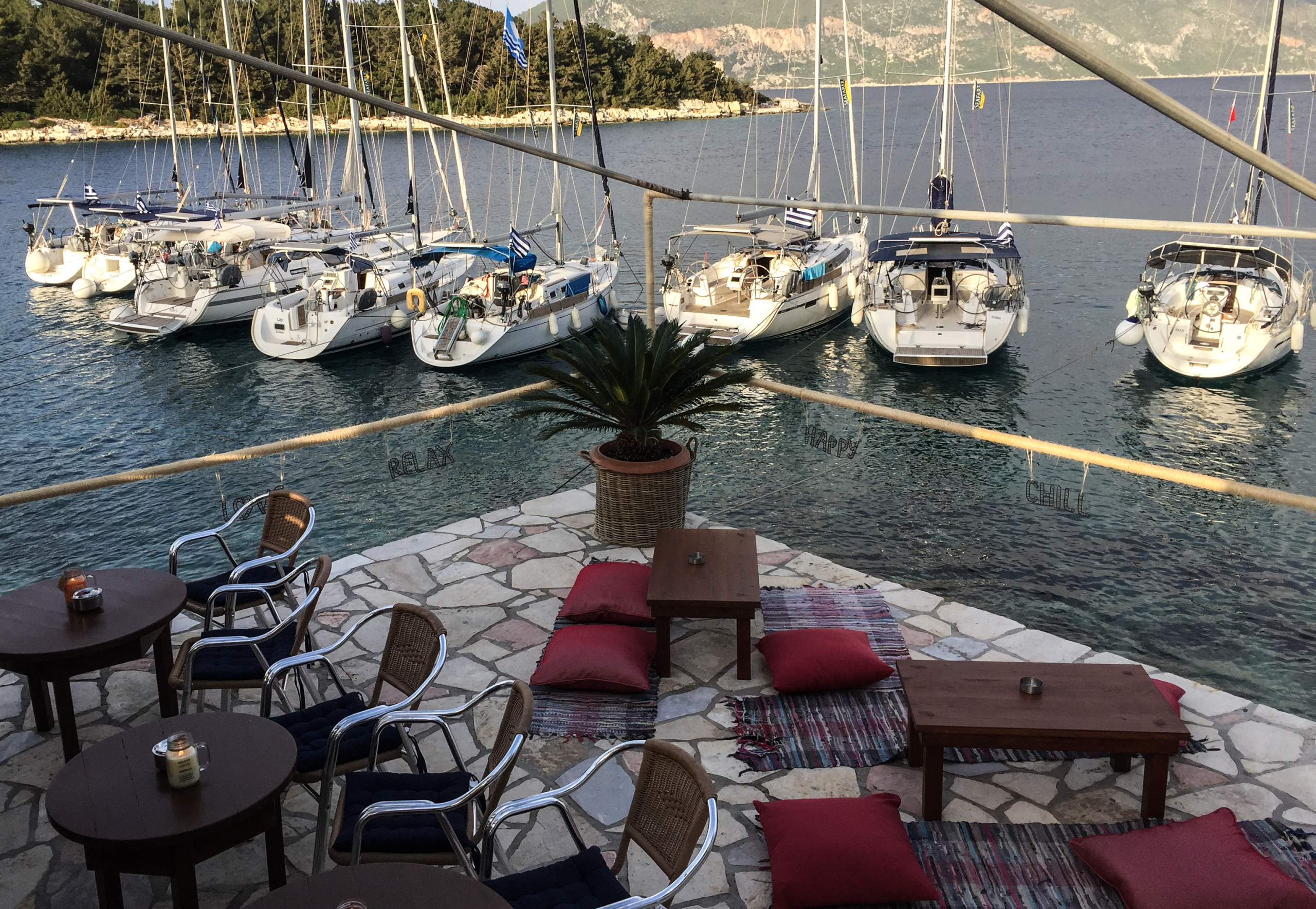
Safely Docked
A safe docking at Poros, Cephalonia, Greece, following an enjoyable passage.
A different method of mooring
Yachts moored outside the port of Fiskardo, Cephalonia, Greece. The method is 'anchor and long line'. The long lines are led from the yacht stern to rocks on the shore
and led back to the yacht sterns. Anchors are laid from
the bow.
© 2016-2024 www.passage-planning.co.uk, www.passageplanning-sales.com and
www.passage-planning.com